The Geography of Karakalpakstan
|
The Geography of Karakalpakstan
|
|
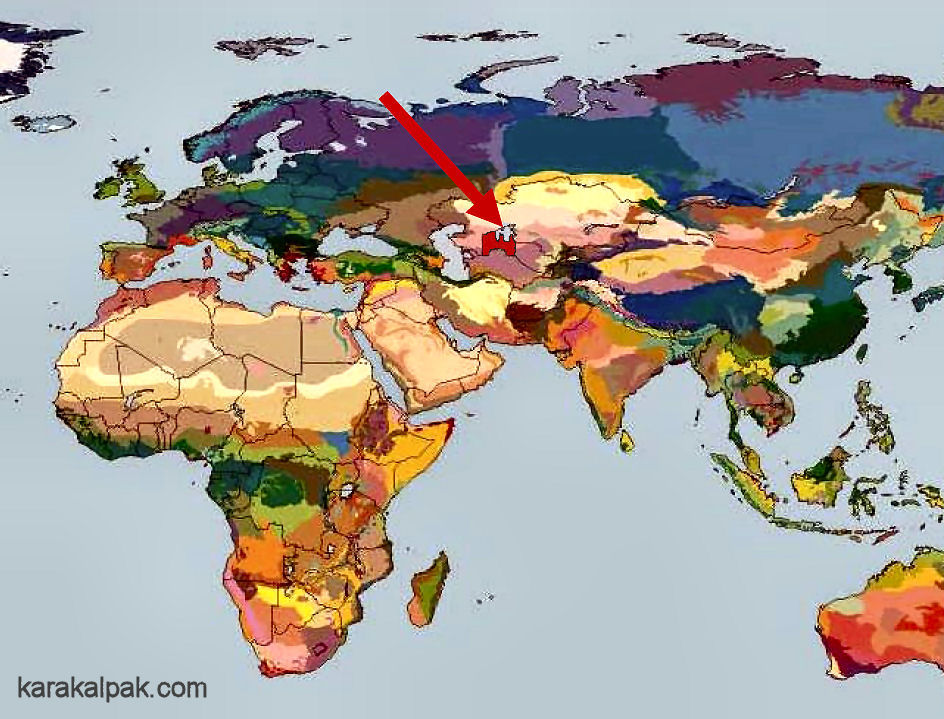
ContentsGeographical LocationThe Aral Basin Climate Physical Features The Amu Darya Delta The Khorezm Oasis The Ustyurt Plateau The Qizil Qum Desert The Sultan Uvays Dag The Bel'taw Heights The Aral Sea and the Aral Qum Vozrozhdeniye Island References Geographical LocationKarakalpakstan is located in western Asia. It lies east of the Caspian Sea, north of the Qara Qum and eastern Iran, and south of the Ural Mountains. The latter are normally taken as the dividing line between European and Asiatic Russia, making Karakalpakstan much closer to Europe than to China or Mongolia.
Karakalpakstan lies north of Turkmenistan and Iran in western Central Asia.
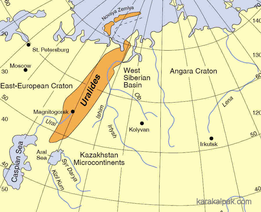
In geological terms Karakalpakstan has one foot in Europe and the other in northern Asia. It sits at the southern end of the Uralian
orogenic belt, a range of mountains and hills that stretch 3,500 km from the the islands of Novaya Zemlya in the Arctic Ocean southwards to the
Aral Sea and perhaps beyond. It was formed by the collision of the East European and the Siberian cratons, or tectonic platelets, a complex event
that occurred during the Palaeozoic, between 400 and 250 million years ago. As the European plate was subducted below the Siberian plate, consuming
the bed of the Uralian Sea, it formed a narrow elevated ridge. The main remnants of this feature today are the Ural Mountains in Russia and the
Mugodjar Hills in Kazakhstan. However this structure seems to continue southwards through the middle of the Aral Sea, folowing the line of the
Kulandy and Vozrozhdeniye Peninsulas. Deep cores drilled by the Russian geologist I. V. Rubanov identified a horst, or uplifted ridge, rising some
1½ km above the floor of the western basin of the Aral Sea below the former island of Vozrozhdeniye. This feature is buried below kilometres of
sedimentation subsequently laid down by the numerous ancient seas that have from time to time inundated the Aral region.
Location of the so-called Uralides between Europe and Siberia.
Geographically Karakalpakstan is situated within the band of northern deserts that stretch from the Moroccan Sahara to the Chinese Gobi. Although not
particularily well defined, in Central Asia the northern boundary of this arid zone lies at around 48°N, well north of the Aral Sea. To the north
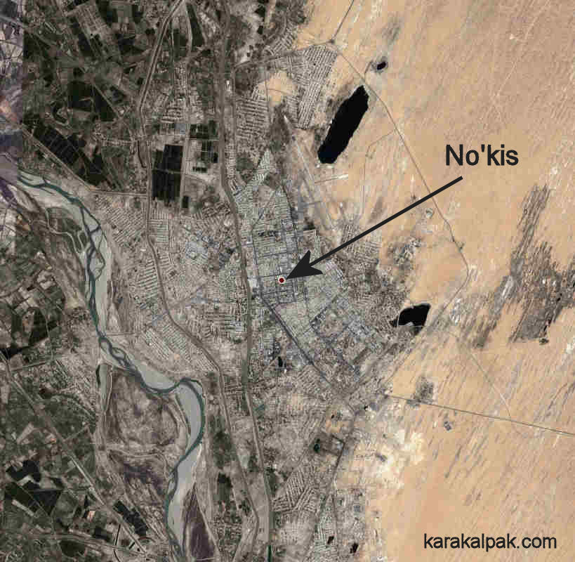
of this boundary lies the vast expanse of the Eurasian steppes, ranging from eastern Europe through Russia and Kazakhstan to Mongolia. No'kis, the
capital of Karakalpakstan, is situated at a latitude of 42.27°N, roughly the same as Rome, Boston, and Chicago.
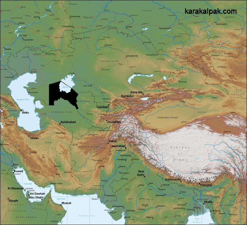
Karakalpakstan lies in the centre of the Aral Basin in western Central Asia.
Bordering the Aral basin to the south-east are massive mountain systems that almost split the Eurasian continent in two. They have a profound effect
on the geography, climate, and agriculture of Karakalpakstan. The valley of the Hari'rud, linking Turkmenistan to Afghanistan, marks the beginning of
the Hindu Kush, which runs eastward to join the Karakorum Range in Pakistan, the western extension of the Himalayas. North of the Hindu Kush and
Karakorum are the Pamirs, a huge complex or knot of mountain ranges, and north-east of these are the Tien Shan (Chinese for Heavenly Mountains), which
stretch for almost 2,500km from southern Kyrgyzstan into the western Xinjiang Province of China. Various chains of mountains extend westward from the
Central Tien Shan, some north of Dushanbe and south of the Ferghana Valley towards Samarkand (the Turkestan, Zeravshan, and Gissar Ranges of the South
Tien Shan), others north of the Ferghana Valley towards Tashkent (the Chatkalski and Pskemski Ranges).
Karakalpakstan is totally surrounded by arid deserts.
|
|
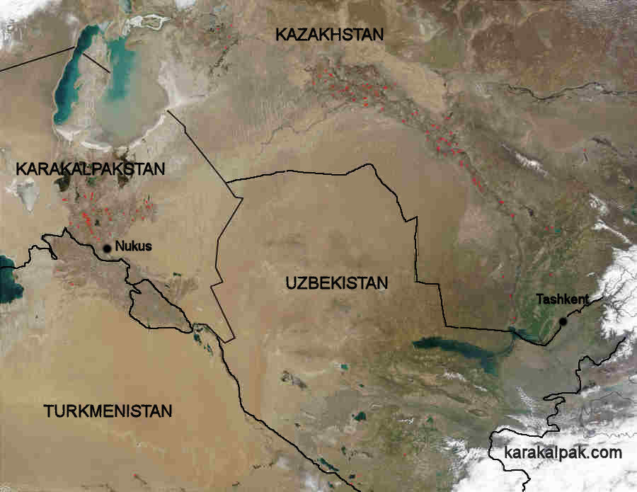
Politically Karakalpakstan forms the western part of the independent Republic of Uzbekistan and, with an area of approximately 166,600 square kilometres,
it accounts for an enormous 37.2% of the Republic's land surface. Of course most of Karakalpakstan is occupied by wilderness - the Qara Qum and the
Qizil Qum deserts, the Ustyurt Plateau, the southern part of the Aral Sea and Vozrozhdeniye Island, and the Sultan Uvays Dag range. Shamuratov
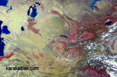
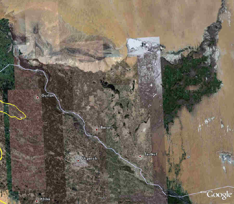
calculated in 1979 that only 16% of its land surface was occupied by the valley of the Amu Darya river, the most habitable part of the province. Modern
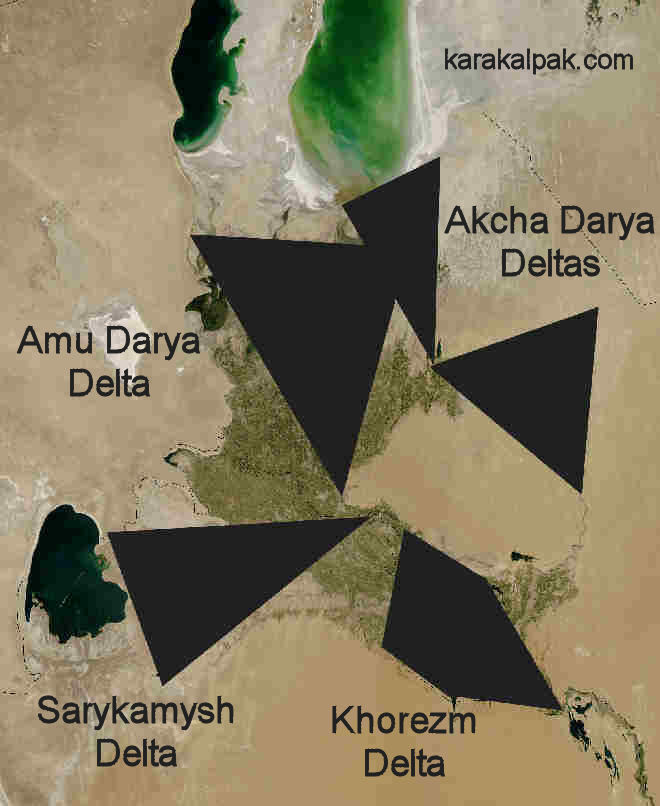
satellite photography shows this situation remarkably clearly:
|
This photograph highlights the arbitrary division between the populations of Karakalpakstan, northern Turkmenistan, and the viloyat of
Khorezm, caused by the attempted partitioning of the former Khorezm oasis along ethnic lines.
The image also shows how the inhabited part of Karakalpakstan is divided into three almost separate regions by the artificial border - the northern
delta of the Amu Darya, sometimes simply called the Aral Delta, the southern oasis on the right bank of the Amu Darya that is essentially the old
right bank part of the Khorezm oasis, and the small enclave around Man'gıt separated out from the left bank part of the former Khorezm oasis.
Following the Russian conquest in 1873 the whole of the Khorezm oasis was partitioned between the supposedly independent Khanate of Khiva on the
left bank of the Amu Darya and the Amu Darya Otdel on the right bank, the latter forming part of Russian Turkestan. During the subsequent
Imperial Russian occupation the latter was administratively divided between the southern Shoraxan Section and the much larger northern
Shımbay Section. This division between south and north remains very pronounced up to the present day.
Climate
Due to its landlocked geographical location the climate of Karakalpakstan is extreme continental. In the summer solar radiation is high and
humidity is relatively low, the average July temperature reaching 28°C in the south and 26°C in the north. However maximum summer
temperatures can reach 45°C, while in the open desert they can exceed 50°C. Winters are moderately cold with little snow, the average
temperature in January falling to about -5°C in the south and about -8°C in the north. Minimum recorded winter temperatures can
reach as low as -32°C. However the flatlands of the delta are sometimes exposed to the cold winds from the Siberian Arctic so, with the
wind chill effect, temperatures can often feel much colder.
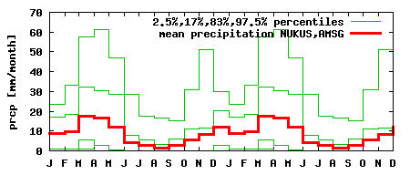
Precipitation varies significantly across Karakalpakstan, as well as from year to year, being much lower in sandy desert regions than in neighbouring
irrigated lands. Within the delta, the most populated region, precipitation averages between 90mm and 180mm (3½ to 7 inches) per annum. The
Hydrometeorological Service Centre of Uzbekistan (UZHYDROMET) reports the average annual precipitation in No'kis ranging from 92mm to 129mm in recent
years, with the mean number of precipitation days per annum running at 72. However considerably wetter years have been frequently recorded over the
past 70 years:

|
|
The wettest months are March and April, while the dryest are August and September. The wind direction is predominantly from the west. Rain is
normally associated with depressions that originate in the eastern Mediterranean and then move in a north-easterly direction over the Caspian Sea
where they are regenerated and strengthened. The cause of the wet spring weather is due to the seasonal increase in convective activity and the
weakening of the Siberian anticyclone. Western cyclones change their direction in the summer over the Aral Sea from a west-east to a north-south
direction. Strong ground winds are relatively frequent in the north-western part of the Amu Darya delta, which experiences storms for about 50 days
per annum. Wind velocity reaches a maximum of 70 to 90 km per hour.
Statistics show that the climate of Central Asia has become slightly more extreme over the past 65 years, with slightly warmer summers and cooler
winters. However the progressive dessication of the Aral Sea over the past 50 years has led to an even greater change in the local climate,
particularly during the last decade. The Aral Sea acts like a regulator, partially mitigating the cold winter winds from the north and producing
a cooling effect during the summer. The massive reduction in the size of the sea and its thermal capacity has led to a dryer and shorter summer, with
temperatures increased by two or three degrees, and longer and colder winters. These effects are the greatest the closer one gets to the Sea's
former shoreline. Precipitation in the northern part of the delta has also been significantly reduced, leading to the progessive desertification
of many of its former marshlands and agricultural areas.
Another climatic change brought about by the shrinking of the Aral Sea and the transformation of its shores into sandy desert has been the increasing
occurence of large dust storms.
|
Dust storms now occur half a dozen times a year in the Karakalpakstan region. Some involve enormous dust clouds, recorded at up to an incredible
45,000 square kilometres in area, capable of transporting sand and dust for hundreds, if not thousands of kilometres. Calculations suggest they
currently remove several million tonnes of sand from the area annually, depositing it to the south and south-west, mainly in the Khorezm oasis. In
addition to sand such storms also transfer thousands of tonnes of salt from the dried-out bed of the Aral Sea to the agricultural regions of
Karakalpakstan and Khorezm. Such storms were rare in the past and have only become frequent with the onset of desertification.
Physical Features
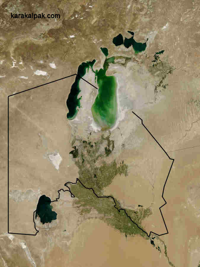
The most prominent physical feature of Karakalpakstan is that it is flat. It has one small range of mountains - the Sultan Uvays Dag - and a few
small outcrops of hills. Most of the deserts are flat or imperceptibly gently sloping and one, the Ustyurt, is situated on an elevated plateau.
Karakalpakstan shares its two largest bodies of water with other independent Central Asian states: the Aral Sea with Kazakhstan and the
Sarykamysh Lake with Turkmenistan. Most people live and work in the irrigated river plain and the delta of the Amu Darya.
|
|
Despite its flatness Karakalpakstan has a remarkably varied landscape. It can be dissected into a number of specific physical features that are best
described individually:
The Amu Darya Delta
The Amu Darya delta is a fairly recent topographical feature. During much of the Quaternary Period - the latest geological era covering the last 2
million years - the Amu Darya flowed from Afghanistan in a westerly direction across the Qara Qum, entering the Caspian Sea in the region of the
Balkan Mountains. Due to mountain building in the Pamirs and Tien Shan and the gradual elevation of the southern Qara Qum the course of the Amu
Darya steadily moved towards the north-west. Following the last Ice Age the Amu Darya continued to change its course until it intercepted the
Zeravshan river. The combined flow of these two rivers eventually breached a natural barrier at Tu'yemoyın (near Lebap), flooding the depression
occupied by the small Lake of Khorezm. As the level of the lake rose it created a huge wetland while the silts deposited from the river formed the
Khorezm delta to its south-east, a region of rich alluvial soils that today forms the agricultural heartland of the Khorezm viloyati and the
southern part of Karakalpakstan.
Any further northward flow into the Aral depression was blocked by the low foothills of the Sultan Uvays Dag so, as new channels attempted to find their way into the Sarykamysh depression and the catchment area
of the Uzboy, the Amu Darya was forced to form a second delta region to the west of the Khorezm Lake. Today this delta region is a desert plain
located between the Sarykamysh Lake and the towns of Konya Urgench and Dashovuz in Turkmenistan.
At some time during the 5th millennium BC the Amu Darya finally managed to breach the foothills of the Sultan Uvays Dag and began to form a third
inland delta to the east of these mountains – the delta of the southern Akcha Darya or New River. Even so the main channel continued to follow the
route of the Uzboy to discharge into the Caspian Sea. However, before the start of the Bronze Age in the 2nd millennium BC, the Akcha Darya seems to
have broken through the low barrier of foothills that had constrained its northern flow, allowing it to run directly north through the Qizil Qum
before turning north-west to discharge into the south-eastern corner of the Aral Sea forming a fourth delta on the south-east Aral coast.
The current or fifth Amu Darya delta has only been formed during the last one and a half thousand years. The Amu Darya seems to have changed
direction yet again just before the onset of the 7th or 8th centuries AD, flowing along the western escarpment of the Sultan Uvays Dag before turning
in a north-easterly direction towards the Aral Sea. This led to the creation of a new eastern delta close to the Beltaw Hills and an internal wetland
in the Da'wqara depression to their south. This vast expanse of new marshland attracted nomadic livestock-breeders, who settled and established the
local Kerder culture. Towards the end of the 9th century AD this north-eastern delta of the Amu Darya began to silt up. A former terminal branch of
the river that flowed towards the north-west was transformed into the main channel, flowing around the edge of the tchink to reach Lake Sudoch,
before entering the south-west corner of the Aral Sea.
|
We know from al-Muqaddasi that in 985 AD the tributary of the Amu Darya flowing towards the Sarykamysh Lake was dammed close to Gurganj, its flow
redirected towards the Aral Sea. Following Timur's destruction of Khorezm in 1389 the dam was destroyed and the Amu Darya resumed its flow into
the Sarykamysh Lake. The resulting medieval Aral crisis led to a major contraction in the size of the Aral Sea and the evacuation and desertification
of much of the Amu Darya delta. It was not until around 1600 that the Amu Darya changed its course back towards the Aral Sea. In 1713 the main
channel flowed down the east side of the delta; in 1750 it flowed down the western side; later it reverted to the east only to switch back again to
the west. In 1950 the main channel was artificially redirected further east again, adopting the central position that it occupies today with its
outflow just to the east of Moynaq.
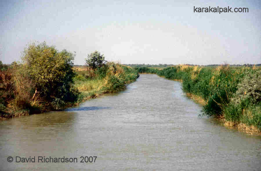
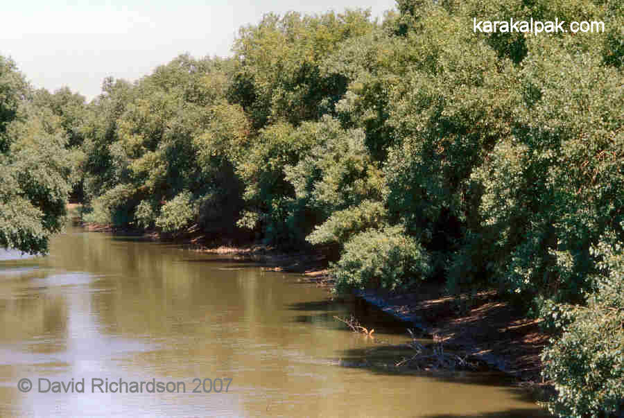
Clearly the Amu Darya delta is not like a normal delta where the main river splits into a fan of smaller channels before discharging into the sea.
The gradient of the delta is too low for the formation of such a feature - No'kis is only 10 metres higher than the old coast line. As a consequence
the Amu Darya delta has been formed by a single meandering river, constantly changing its route, switching eastwards and westwards across the delta
region as its former beds become choked with silt. It has left behind a flat plain of generally good alluvial and clayey soils covered by a
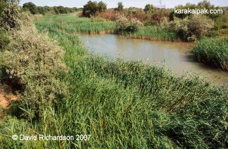
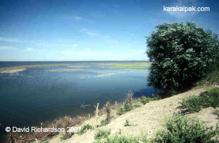
patchwork of lakes, marshes, and reed beds, many formed in the old disused channels. Many of the former lakes and marshes have drained in recent
decades, while the old river beds have been exploited throughout history by the delta's inhabitants to build irrigation canals. Here and there
the plain is interrupted by small ranges of low hills - the Qusxanataw north of Shımbay; the Qızıljar on the left bank of the Amu Darya; and
the Beltaw Heights north of Taxta Ko'pir. The latter are the highest but even then only reach a meagre 142 metres above sea level.
|
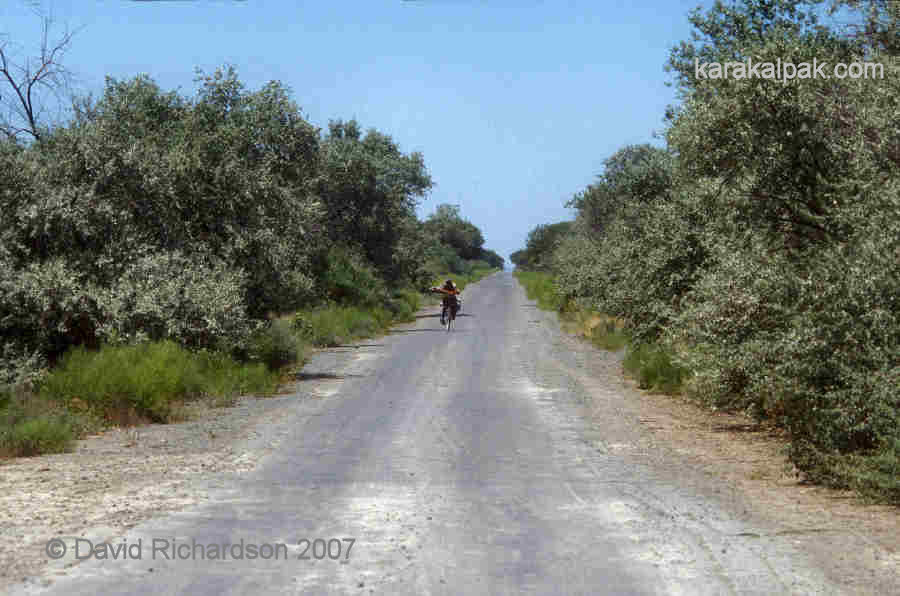
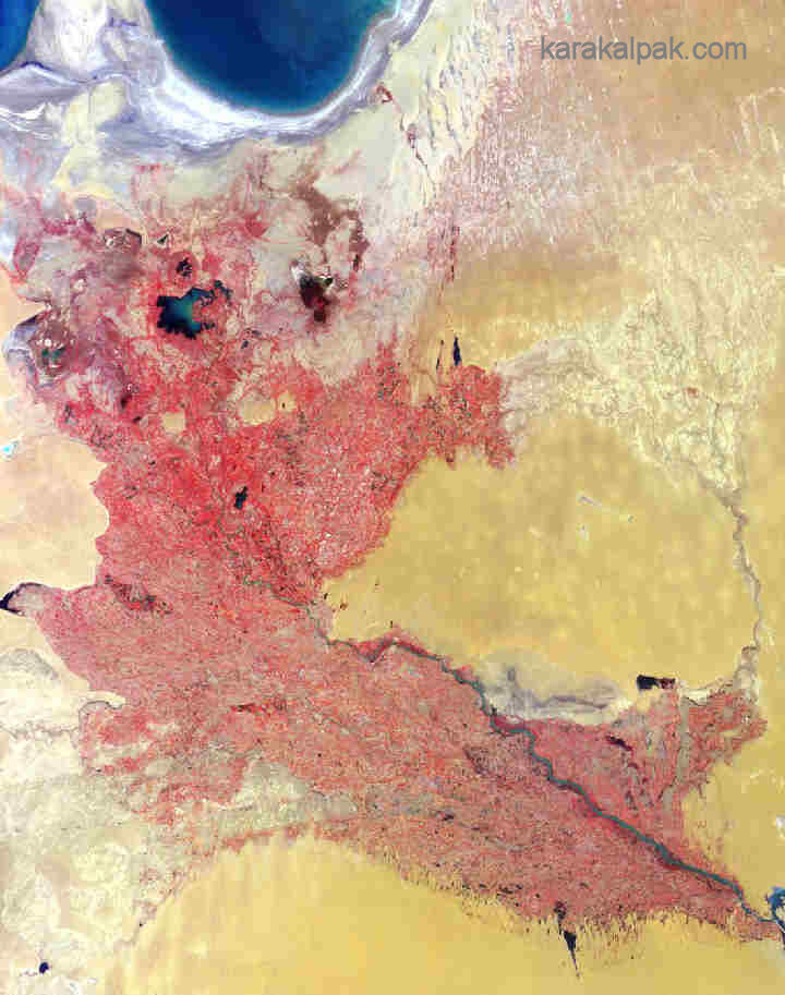
During the Soviet era the Amu Darya delta has been changed beyond recognition. Its multitude of lakes and marshlands have been drained. Extensive
tugay forests bordering the Amu Darya and other rivers and canals have been cleared. Extensive pastures and hay meadows have been ploughed
up into agricultural farmland. Cart tracks have been turned into roads and the once feudal agricultural system has been modernized, with the development
of a proper irrigation network and the collectivization and mechanization of small farms. According to an INTAS study, reported by de Schutter and
Dukhovny, the surface area of the lakes in the Amu Darya delta has declined from 4,000 km² in 1960 to 260 km² in 2001. The area of
tugay has reduced from 13,000 to 500 km², while reedbeds have declined from 6,000 to 300 km². Clearly many of these changes have
been mirrored in the Western world as a result of agricultural and economic development.
|
|
However the development of intensive and inefficient cotton, wheat, and rice farming throughout Soviet Central Asia, coupled with the excessive use of
chemical fertilizers and the application of defoliants on the cotton crop has cascaded out of control into a major ecological crisis, with
Karakalpakstan and neighbouring Khorezm bearing the brunt of its effects. As more and more of the Amu Darya's water has been diverted for irrigation
upstream, especially in Turkmenistan, so the volume reaching the Amu Darya delta and the Aral Sea has continued to decline, precipitating the current
Aral Sea disaster - see the Aral Sea section below. Many canals in the northern part of the delta have now ceased to function and
the Amu Darya itself is frequently reduced to the size of a small stream, making little contribution to the Aral Sea at all.
|
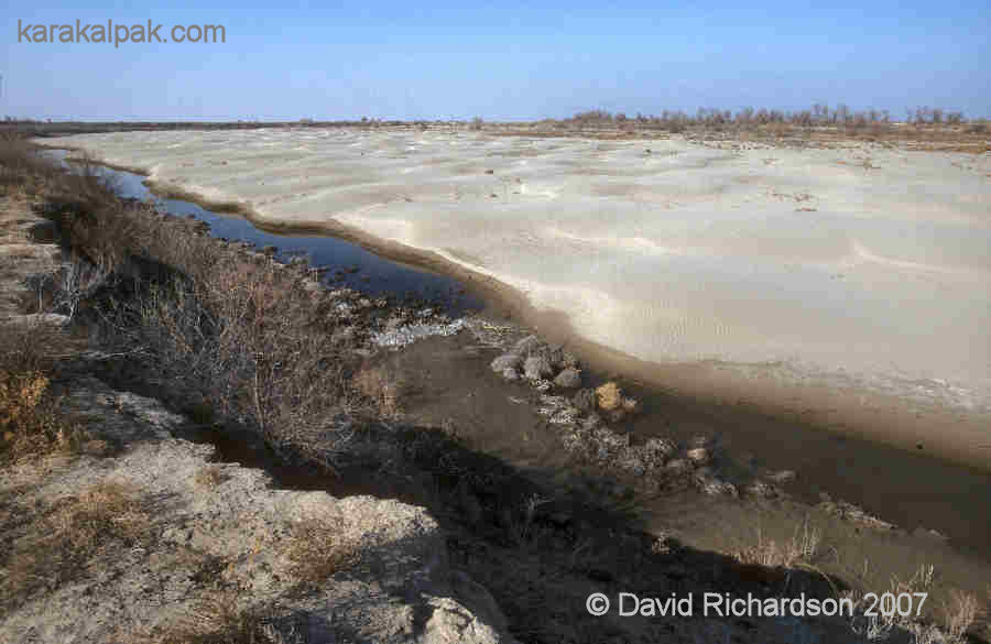
The groundwater table has been reduced by up to 8 metres and riverbeds have been lowered by up to 10 metres. As such, much of the farmland and
marshland grazing in the northern delta has turned into desert, extending the size of the Aral Qum. The water authorities have responded by damming
the main outlets into the Aral Sea, thereby reserving freshwater supplies in a number of large lakes and ponders. It is possible that more of these
artificial lakes will be added in the future.
|
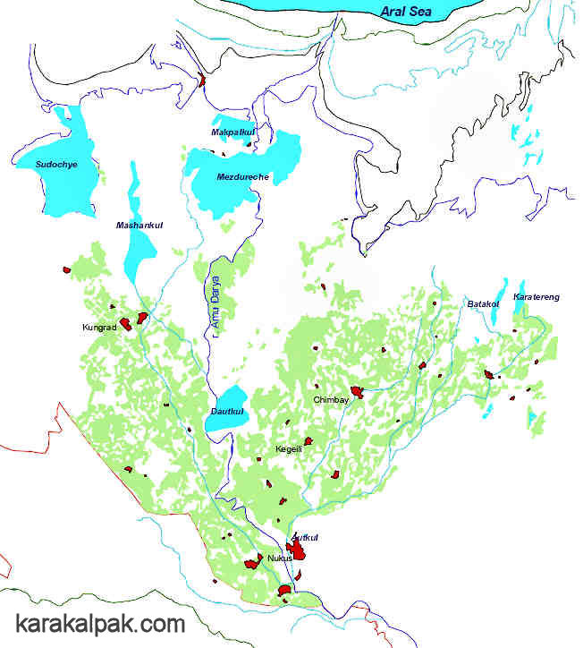
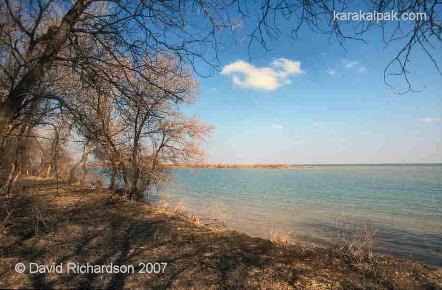
The largest lakes today include the Lakes Sudoch and Mashankul north of Qon'ırat, fed by the Lenin and Ravshan Canals respectively; Lake Makpalkul
north of Shege and Lake Mejdureche (meaning "between the rivers") south of Shege; Lakes Batakol and Qarateren' north of Taxta Ko'pir, both fed by the
Qaraketken Canal; and Lake Dowat Ku'l close to Erkindarya, fed by the Shurtambaw Canal. The size of these lakes can vary considerably, depending on the
level of the Amu Darya. During the drought of 2001 they were greatly reduced in size. The fish stocks supported by these lakes have gone some way to
offsetting the loss of the Aral Sea fishery. Although Sarykamysh Lake (shared with Turkmenistan) is much larger than any of these water bodies, it is
located outside of the delta region, being sandwiched between the Qara Qum desert and the Ustyurt Plateau. This too is an important fishery and has
expanded significantly in recent years as a result of the drainage of agricultural waste water into the Darya Lyk.
|
|
Another ongoing problem is salinization. Just like the oceans, the Aral basin acts like a huge salt collector. Much of the salt - sodium chloride and
sodium sulphate - has accumulated below the surface in the subsoil. Agricultural irrigation dissolves some of this salt and brings it to the surface.
This phenomenon, known as secondary salination, has been the curse of the local farmer for millennia. In the past the development of irrigated farming
in a particular area ultimately led to its own demise because of the salting up of the soil. Today local farmers attempt to overcome this problem by
flooding the land before the growing season in an attempt to flush away the salt. A network of collector canals lying at a lower level than the
irrigation network drain away the waste water. However this simply accentuates the problem downstream and increases the problem of waterlogged soil.
Salt levels continue to rise throughout the delta and the farmland in many regions has become unusable.
|
|
As a consequence the main agricultural region has become confined to the southern half of the delta. The main crops continue to be cotton, rice,
wheat, fodder, and maize.
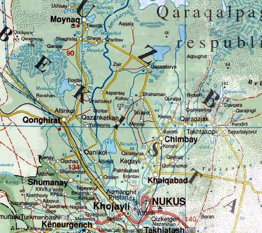
The Amu Darya delta region of Karakalpakstan is divided into the No'kis metropolitan area and eleven regional administrative districts: No'kis,
Kegeyli, Xojeli, Bozataw, Shomanay, Qanlıko'l, Qon'ırat, Moynaq, Qarao'zek, Taxta Ko'pir, and Shımbay.
|
No'kis, the capital of Karakalpakstan, is strategically located at the southern entrance to the delta. It is named after one of the Karakalpak
tribes. In 1873, at the time of the Russian annexation, it was a small rural village located close to an important river crossing as well as
the start of the caravan route to Kazalinsk. General Ivanov decided that it would be an ideal site for his second new Russian garrison. Work began
on the construction of Fort No'kis during the summer of 1874. Unfortunately for Ivanov the location turned out to be less than satisfactory, with
the site subject to flooding and with an absence of clay for brickmaking. Ivanov decided that he would limit the size of the fort to 350 men and
would site his main garrison at Petro-Aleksandrovsk, which therefore became the main administrative headquarters for the Amu Darya Division. Soon a
port was developed for the Aral Flotilla and a small European-style civilian town grew up around the Russian fort.
|
The initial Soviet attempt to modernize Karakalpakstan made limited headway during its first five years as an autonomous oblast. Consequently
it was transferred to the Russian Federation in 1930 and was elevated in status to an Autonomous Republic in 1932. With the support of their Russian
advisors, the new Central Executive Committee sitting in To'rtku'l decided within months to found a new capital city at No'kis. When Ella Maillart
visited No'kis in the winter of 1933 work was already well under way on a new hospital and new workers were arriving from Kazalinsk. The capital was
finally transferred from To'rtku'l in 1939.
|
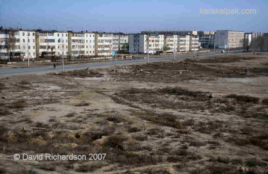
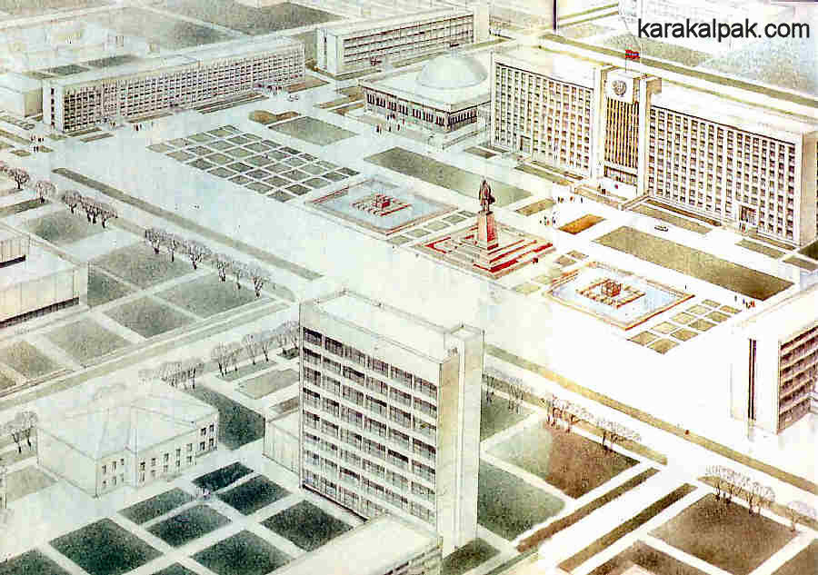
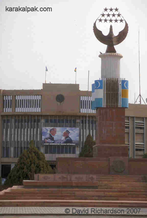
Today No'kis is a typical Soviet town, laid out on a grid basis with a population of about 240,000. It is the seat of the so-called autonomous
government and the administrative centre of Karakalpakstan, housing the Joqarg'ı Ken'es or Supreme Council and the executive Council of
Ministers. It is also the main commercial, industrial, scientific, and academic centre of Karakalpakstan, although most of its factories are
currently in a fairly decrepit state having lost most of their Soviet markets in the 1990s. The main industries are in textiles, marble cutting
and polishing, food processing, pasta and flour making, and printing and publishing.
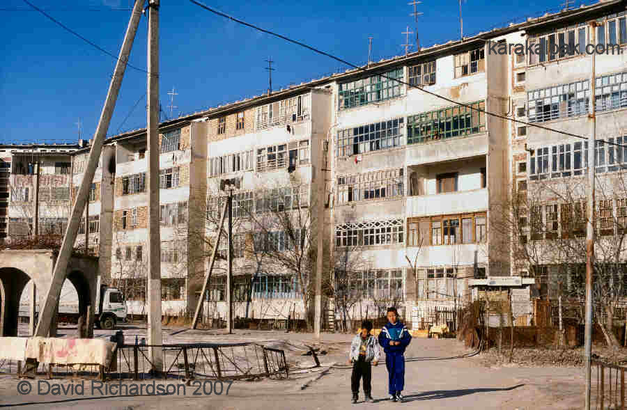
No'kis is also a major residential centre, with a combination of low-rise housing and multi-storey apartment blocks, many lying close to the
city centre.
|
Much of the city was developed from the 1960s onwards. In the 1950s the USSR reduced the incentives for growing cotton and this gave rise to the
start of a population movement from the countryside to the cities. Since the 1960s and 1970s the Aral crisis has led to a significant migration of
people from the northern delta into the capital, swelling its population. In 1991 President Karimov even announced a plan to move No'kis itself 50 km
to the south to improve the availability of water for its residents. However nothing transpired. Today the No'kis urban area extends into the
satellite settlements of Taqıyatas and Xojeli, the latter having a population close to 80,000 and being connected to the city by a new road bridge
across the Amu Darya. Taqıyatas is the site of the lowest dam on the Amu Darya and a hydro-electric power station that supplies Karakalpakstan with
its electricity needs.
|
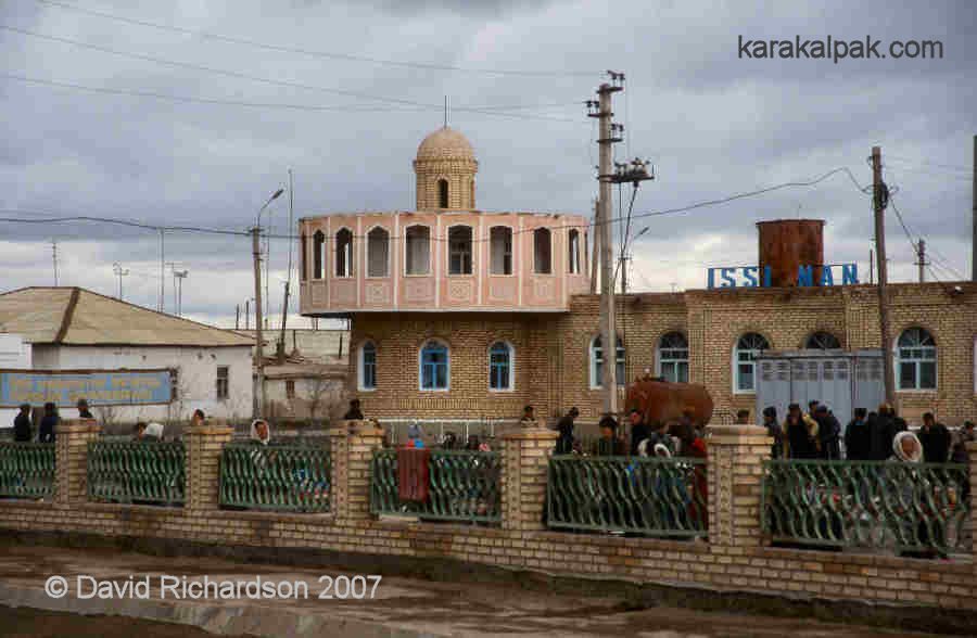
The two largest towns in the delta are Qon'ırat and Shımbay, the two oldest setlements in the region, both founded by nomadic Aral Uzbeks
in the 17th century. Both have an estimated population of about 50,000. Each is individually connected to No'kis by a long straight road.
|
|
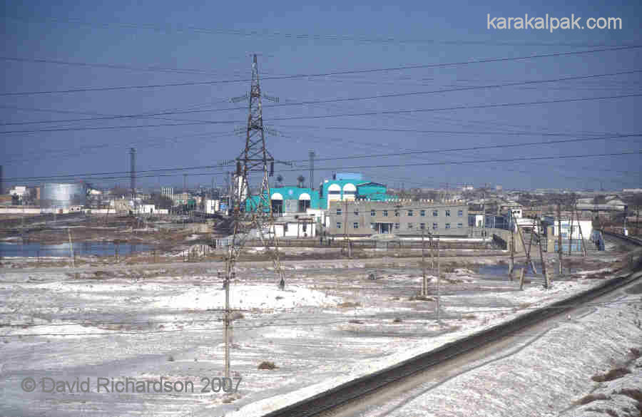
Today Qon'ırat is the main industrial centre in the northern delta and is also the local transhipping depot, being located on the southern
rail connection between Tashkent and Moscow. It has a major railway maintainance and repair workshop and has become an important support centre
for the Karakalpakstan gas pipeline network. One of the compressor stations for the Bukhara-Urals pipeline is based in the town. It also has
a regional cotton mill and a meat-packing plant. Shımbay is a more rural centre with its economy dependant on agriculture and cotton
processing, cooking oil extraction, and building materials.
The next biggest town is Taxta Ko'pir, half Karakalpak and half Qazaq. There are no bridges across the river north of No'kis, although it is possible
to cross the almost dried-out riverbed at Porlıtaw in a four-wheeled-drive vehicle. Travel between Shımbay and Qon'ırat is only possible
via No'kis.
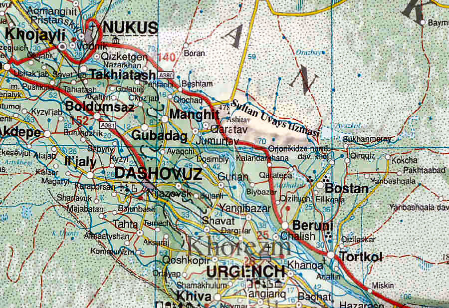
The Khorezm Oasis
The Khorezm oasis was formed as an internal delta of the Amu Darya during the early Holocene. Initially settled by mesolithic hunters and fishermen -
the Keltiminar - during the 5th millennium BC, it was subsequently developed into the agricultural heartland of the region. It has been politically
and economically integrated for most of its history. The creation of the different Soviet Republics in 1925, followed by the collapse of the USSR in
1991, resulted in its partitioning between the independent Republics of Uzbekistan and Turkmenistan. As a consequence Karakalpakstan includes two
artificial portions of the former Khorezm oasis - the right bank enclave around Biruniy, formerly known as the Shoraxan Section, and the smaller
left bank enclave around Man'gıt. Both are rich agricultural regions. They both have a higher ethnic population of Uzbeks and feel more Uzbek
than Karakalpak. Both enjoy a higher standard of living than the population of the Amu Darya delta.
|
The right bank region of southern Karakalpakstan is bordered along its south-west by the Amu Darya, in the north-west by the Sultan Uvays Dag,
and elsewhere by the Qizil Qum. The dried-up internal delta of the Akcha Darya lies to its north, lost in the Qizil Qum. The irrigated region is
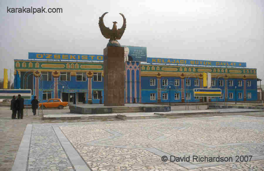
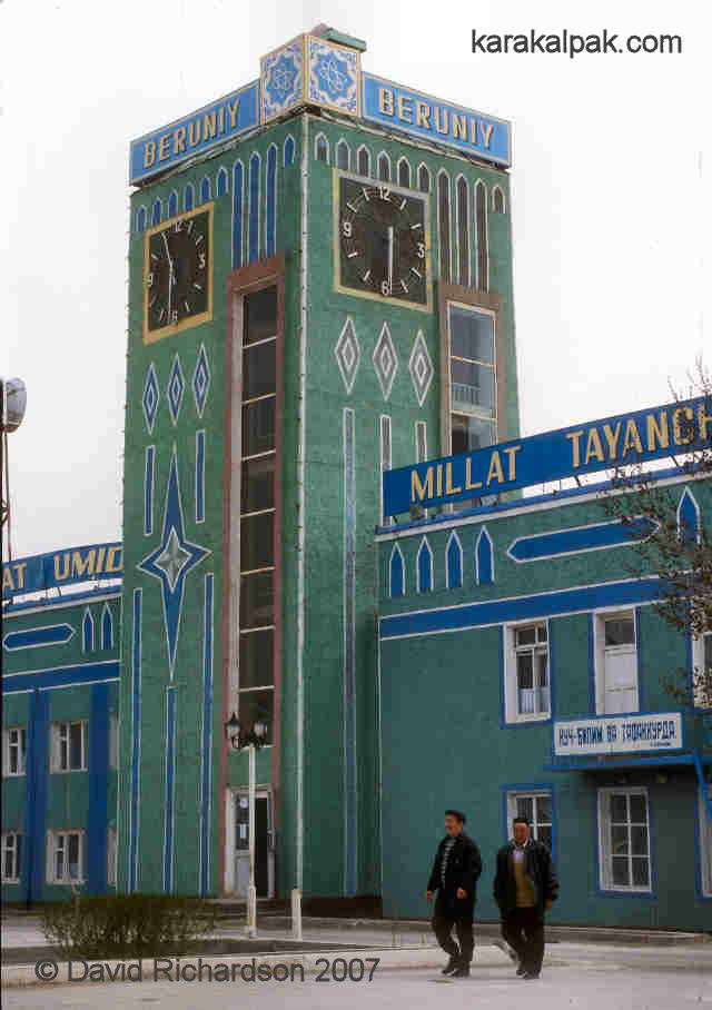
intensively farmed for cotton and wheat. The main urban centre is the industrialized town of Biruniy, with the smaller town of Bostan laying to its
north. The town of To'rtku'l in the south-east was the capital of Karakalpakstan until 1939, mainly for historical reasons. It was formerly known
as Petro-Aleksandrovsk, having been chosen as the site of the first Russian fort in 1873. It subsequently became the headquarters of the Tsarist
governor of the Amu Darya Otdel.
|
This region has been irrigated and farmed for 2½ thousand years. Parts of its northern and eastern boundary are still lined with the ruins of
4th century BC defensive forts, built to protect the early civilization of Khorezm from nomadic attack. The ruins of Dargash, one of the early
fortified capital cities and religious centres, lays close to Bostan while the ruins of the later royal palace of al-Fir lie in a suburb of Biruniy.
The ruins of a small part of ancient Kath lies on its outskirts.
|
Administratively the region is divided into three districts: Biruniy, To'rtku'l and Ellikqala. The administrative centres are Biruniy city, To'rtku'l
and Bostan.
The two southern districts have suffered throughout history from the erosion of their river banks by the Amu Darya . The old fort of al-Fir close
to modern Biruniy was abandoned due to flooding in the 10th century and the commercial centre of Kath was built away from the river. Likewise the
original town of To'rtku'l was destroyed by the Amu Darya over the period of a decade. In 1925 the Amu Darya was 8 kilometres from To'rtku'l. In
1937 the town was severely flooded for the first time and by 1950 the last street had been washed away despite all the measures taken to defend the
town. The occupants were resettled in the new town of To'rtku'l in 1949, constructed several kilometres away from the river.
|
Biruniy and To'rtku'l are the main economic centres of this region, with populations estimated at around 50,000. Both are centres of cotton processing.
However Biruniy is surrounded by numerous derelict-looking heavy industrial facilities, while To'rtku'l is a centre of light industry. A new
cotton-spinning and weaving plant has recently been opened. The residential areas surrounding To'rtku'l have a more prosperous appearance than other parts
of Karakalpakstan. The economy of To'rtku'l has been boosted by the construction of new railway line and station, which opened in 2002, linking the
town directly to No'kis. With the completion of the new "Amudarya" railway bridge in 2004, the town is now also linked to Urgench in neighbouring
Khorezm viloyati. The new bridge has been designed with the rails embedded into a tarmac surface, so the bridge also doubles as a road crossing.
|
|
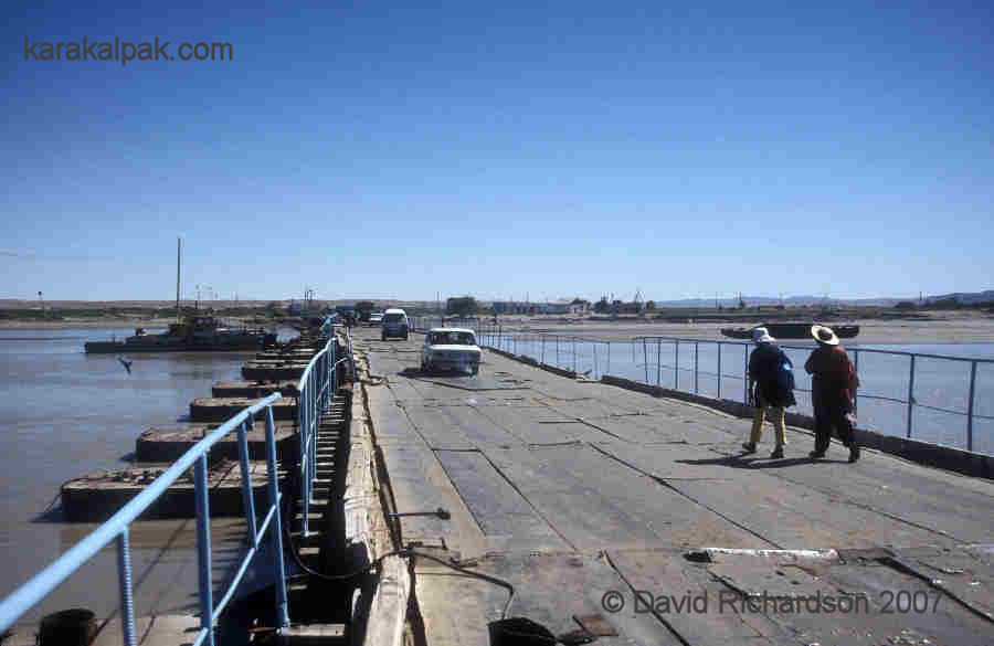
Biruniy is linked to Urgench and Khiva in the Khorezm viloyati by a older pontoon bridge composed of a line of moored barges. Because it
crosses the provincial boundary there are check-points at each end. This ramshackle bridge is under constant repair and is sometimes unpassable for
large vehicles if the level of the river drops too low.
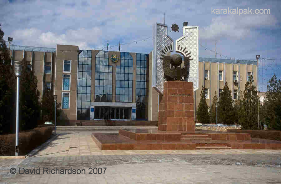
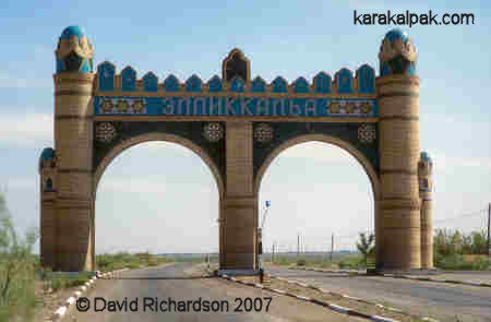
Bostan is about a quarter of the size of Biruniy and is the headquarters of the agricultural Ellikqala district, named after the many ancient mud-brick
qalas spread across the region. It also contains a small population of settled Turkmen.
|
|
The small left bank enclave around Man'gıt forms the Amu Darya division of Karakalpakstan. It is sandwiched between Turkmenistan, the
viloyat of Khorezm, and the Amu Darya. The 105 km long border with Turkmenistan is sealed off with a barbed wire fence. This region
is linked to right bank Karakalpakstan by a second rickety pontoon bridge. In some winters the bridge has to be opened because of ice drift
on the Amu Darya.
|
With a population of about 150,000 this is another intensively farmed agricultural and cotton-processing region with an increasing proportion of
ethnic Uzbeks. The population of Man'gıt is estimated at around 33,000.
The Ustyurt Plateau
The desolate Ustyurt plateau separates the Aral Sea from the Caspian Sea like a huge island. It is composed of Sarmatian white limestones, clays,
and sandstones and its vast elevated surface is covered with a rocky limestone desert that protects it from erosion. The elevation of the plateau
took place as a result of tectonic movements during the late Miocene, about 7 million years ago, possibly as a consequence of the collision between
India and Eurasia. Erosion by acid rain, and more recent earthquakes, may be the cause of the many huge rock falls along parts of its edge. The
plateau has also been subjected to intense wind and sand erosion, as can be readily seen from the sculptured faces of the
tchinkin exposed places.
The plateau is devoid of sand dunes and is sparsely covered with dry low-lying vegetation, which rarely exceeds knee height. Small hills, dried salt
marshes, lakebeds, and outcrops of sand occasionally break its otherwise featureless landscape. Within Karakalpakstan one of its largest features is
the Barsakelmes dry salt lake, which shows up as a prominent white feature on satellite images. The name Barsakelmes means "if you go in, you won't
come out." Some regions of the Ustyurt, such as the region close to the Sarykamysh Lake, are rich in cave systems formed by the erosion of the limestone
rock by acid rain.
|
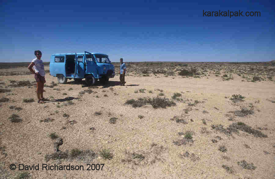
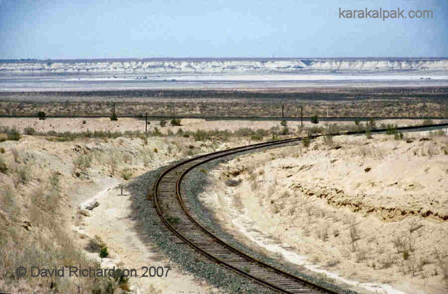
The plateau is criss-crossed by a myriad of sandy tracks, especially along its eastern escarpment. This is an old caravan route linking the Khorezm
oasis to Emba, Orsk, Orenburg and the Russian steppes. Today it is used by the occasional small-time smuggler. Another caravan route ran in a
north-westerly direction towards Beyneu and the northern Caspian shore. During the Mongol period, when Khorezm was an important trading centre within the
Qipchaq (or Golden) Horde, the route was lined with a chain of caravanserais and was used by Genoan merchants travelling between Tanais on the Black
Sea, Saray on the Volga, and Urgench. Today this is the route of the railway line that links Karakalpakstan to Makat, the junction with the Orsk to
Astrakhan line, and ultimately to Moscow.
|
Despite its desolation the Ustyurt supports one of the best-preserved herds of shy saiga deer who annually migrate south across the plateau from
Kazakhstan with the onset of winter. In the historical past they were hunted in great numbers using vast funnel-shaped traps known as arans,
the ruins of which still remain on the plateau. Over the last decade the size of the Ustyurt herd is estimated to have fallen from 200,000 to just
15,000. The Ustyurt forms a transition zone between the northern deserts of Central Asia and the steppe lands of the Urals. As such it supports an
unusual ecology. Other mammals include the goitered gazelle and the Ustyurt mountain sheep. It is also home to the rare houbara bustard, the sand
grouse, the sakar falcon, the steppe eagle, and the golden eagle.
|
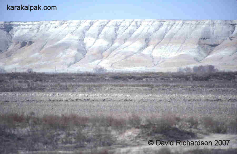
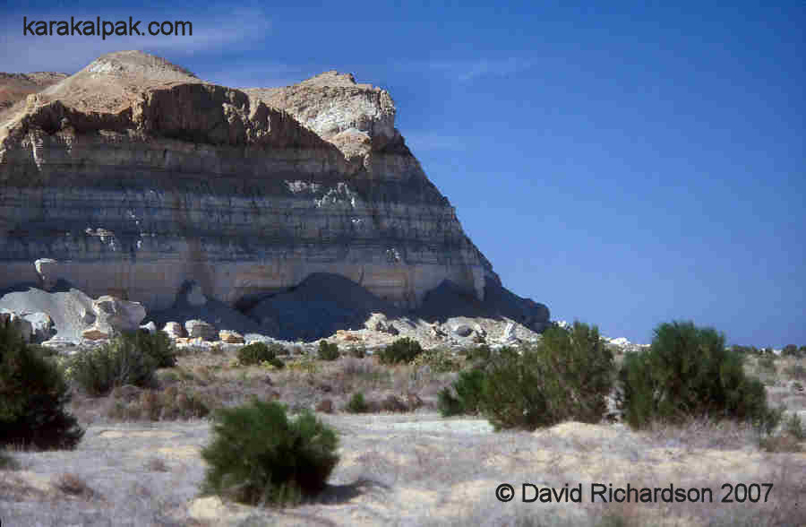
The Ustyurt terminates abruptly along its eastern and south-eastern edges with banded limestone cliffs, averaging 100 to 200 metres in height but
reaching up to 275 metres on the south-western Qarabaur ridge and up to 219 metres at Cape Aktumsyk. It was called the tchink by the early
Russian explorers. In places it forms dramatically shaped cliffs and headlands stratified into layers of white, green, grey, yellow, and orange rock.
The edge of the tchink has been affected enormously by landslides, probably due to past tectonic activity. As a consequence the foot of the
cliff has been turned into an obstacle course of huge boulders, screes, and hillocks, making it an almost impenetrable barrier for much of its 1,500 km
length until it reaches the shallow gulf of the Caspian, the Kara-Bogaz-Gol. There are a handful of places where there are tracks leading to the top
of the plateau, capable of being traversed by a four-wheel-drive vehicle.
|
During the Soviet era the Ustyurt was exploited for its remote inaccessability. In 1970 three underground nuclear bombs, ranging in strength from
30 to 85 kilotonnes, were exploded some 200km west of Jaslıq at the Say-Utes nuclear test site in West Kazakhstan. The objective of two of these tests
was to see if there was a quick way of producing underground storage cavities for natural gas condensate, while the third was a seismology
application being tested by the Ministry of Geology.
During the early 1980s the Ustyurt was used as a chemical weapons test site. The Soviet military established a top secret chemical weapons
research institute in No'kis to develop a new type of highly lethal binary chemical weapon called "Novichok", meaning "new guy". This new gas was
purported to be five to eight times more toxic than VX nerve gas. Tests were conducted over an enormous area of the Ustyurt stretching from the
east of Jaslıq to the central and northern parts of the plateau under the pretext of a project to develop smoke bombs. At one time 300 scientists
were involved in the programme. Many thousands of saiga and other animals were gassed inadvertently as a result of these tests.
Today the Ustyurt is the location of Uzbekistan's notorious high-security prison Jaslıq. Based on the site of a remote former Soviet army base,
work began on the prison in 1997 and it was opened in 1999. It reportedly holds up to 500 prisoners. It is supposedly reserved for terrorists and
extremely violent criminals. However local human rights groups claim that it is all too frequently used for political and religious prisoners. The
facility is associated with numerous reports of extreme torture, and the mistreatment and unexplained deaths of inmates. Jaslıq is only accessible
by rail, and train passengers can only disembark with a special permit. United Nations representatives have so far either been refused entry or have
been given very restricted access.
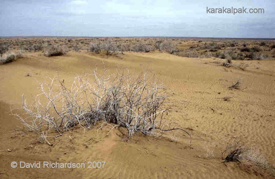
The Qizil Qum Desert
The Qizil Qum lies to the north-east of the Amu Darya, extending over much of central Uzbekistan and into southern Kazakhstan. It has a more complex
landscape than the Qara Qum with higher elevations, especially towards the remote outcrop of the Bukantaw hills in its centre. The western
Karakalpak part is composed of sandy desert, with sand ridges and numerous low sandy hills and dunes, but no barchans. In between lay flat
clayey takyrs and solonchaks, some filled by reed beds.
|
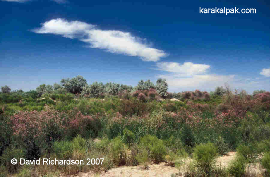
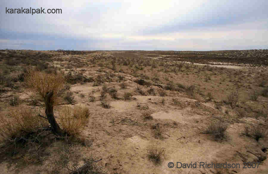
According to Professor René Létolle's observations in 1998 the Qizil Qum bordering the eastern shoreline of the Aral Sea has
retained some of its original natural features, with dunes separated by solonchaks, the latter sometimes containing saltwater pools. These are
interrupted by occasional thickets of dense saxaul, tamarisk, and other trees. The region located to the south-east of the Aral Sea is intersected by
many of the old channels of the Jan'a Darya and the Akcha Darya rivers, which in places appear as strips of bare clay steppe and in others depressions
containing pools of salt water.
|
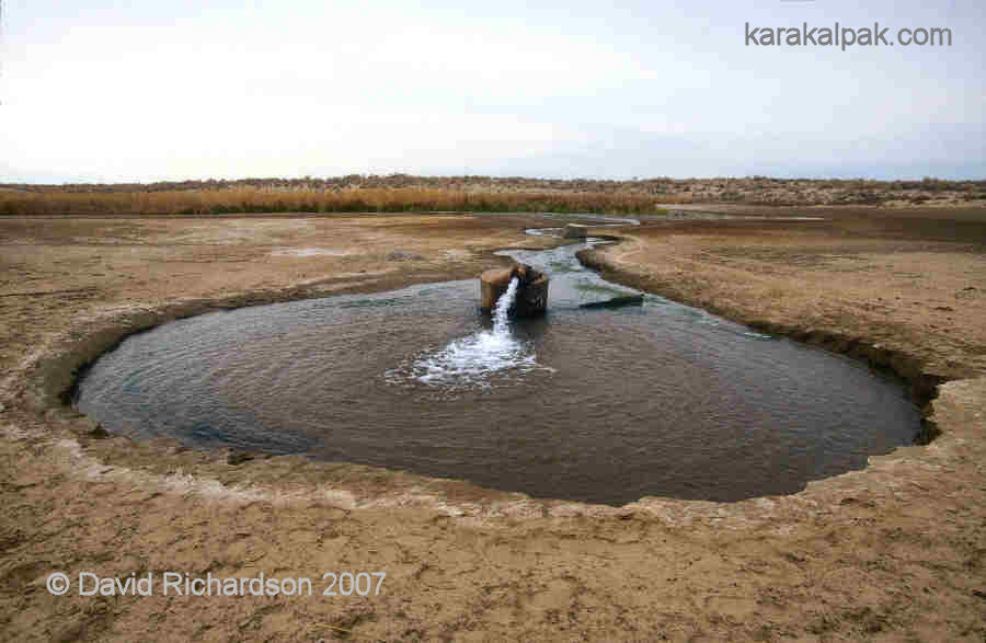
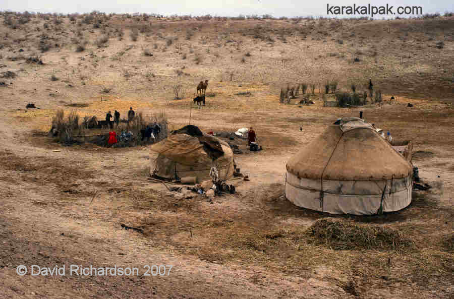
Despite the scarcity of fresh water and the limited amount of vegetation nomadic livestock-breeders have been able to survive in this hostile region
throughout history, primarily breeding sheep, but also raising cattle, horses, and camels. In the spring the western part of the Qizil Qum is covered
with a type of sedge that is a valuable resource for grazing herds. Today this region is exploited by a few nomadic Qazaq families who raise karakul
sheep for the production of astrakhan lambskins and meat. Some are located in the region east of Taxta Ko'pir while others are to be found around
Chuqurqaq close to the eastern border of Karakalpakstan. During the 1950s numerous artesian wells were drilled across the desert to provide a source
of water for livestock.
|
|
Further east, beyond the border of Karakalpakstan, there are increasing numbers of rocky hills. The region around Tamdı, close to Zeravshan, has
been a major sheep-breeding region for many years. Prior to the 1930s it was part of Karakalpakstan, but today it falls within the Navoi
viloyati of Uzbekistan.
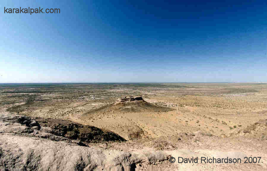
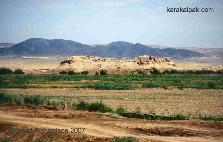
The Sultan Uvays Dag
The Sultan Uvays Dag is a small range of ancient mountains, roughly contemporary with the Urals in geological age. They lie close to the right bank
of the lower Amu Darya in southern Karakalpakstan and were once known as the Chagra Mountains but were later renamed after a holy Muslim cleric.
In 1868 Arminius Vambery referred to them as the "Oveis Karayne" and was agreeably surprised by the luxuriant vegetation and the woods that covered
several of their peaks. He also recorded that a prominent peak close to the Amu Darya was crowned with the ruins of an old castle. In the late 19th
century the lower heights to the west and north-west were known as Sultan Djeyli, while the north-eastern peaks were called Altyn-taw (gold mountain).
Although only just under 500 metres in height, they are the most prominent feature in the entire region. Today they are devoid of vegetation. Their
blueish ridges and rocky peaks stand out from the surrounding desert plain and create the impression of a much larger mountain massif. The Qizil Qum
to the north of these mountains is elevated by around 100 metres above the rest of the desert plain.
|
The Sultan Uvays Dag sit at the western extreme of a deep subterranian geological fault that runs eastwards through the Qizil Qum and the Nurata
Mountains to the Turkestan-Alai and Atbashi-Inylchek mountains of Kyrgyzstan and up to to the Chinese border. Probably associated with ancient
tectonic movements and associated flows of magma, this feature seems to be a source of mineral deposits such as gold, silver, platinum, uranium,
zinc, copper, nickel, rare earth elements, and diamonds. To date the Sultan Uvays Dag is known to contain deposits of granite and other crystalline
rocks including red and white marbles, talc, Khorezmian turquoise, garnet, and beryl.
|
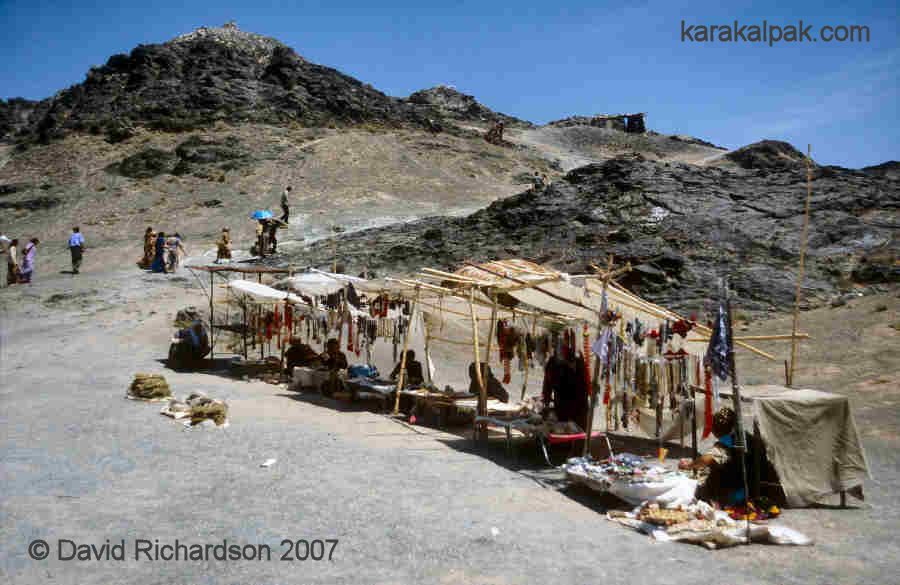
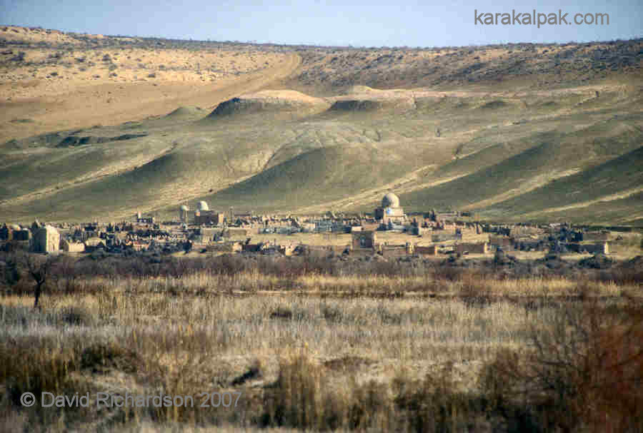
The Sultan Uvays Dag is home to the mausoleum of Sultan Uvays Bobo, reputed to be a descendant of the Prophet. Regarded as a sacred site, the
mausoleum is surounded by a massive cemetery. Close by in the mountains there is a feature claimed to represent the knee imprint of the Prophet.
Many pilgrims come to visit this region. Women who cannot conceive tie rags to tree branches placed on the top of stone beacons in the hope of
becoming fertile.
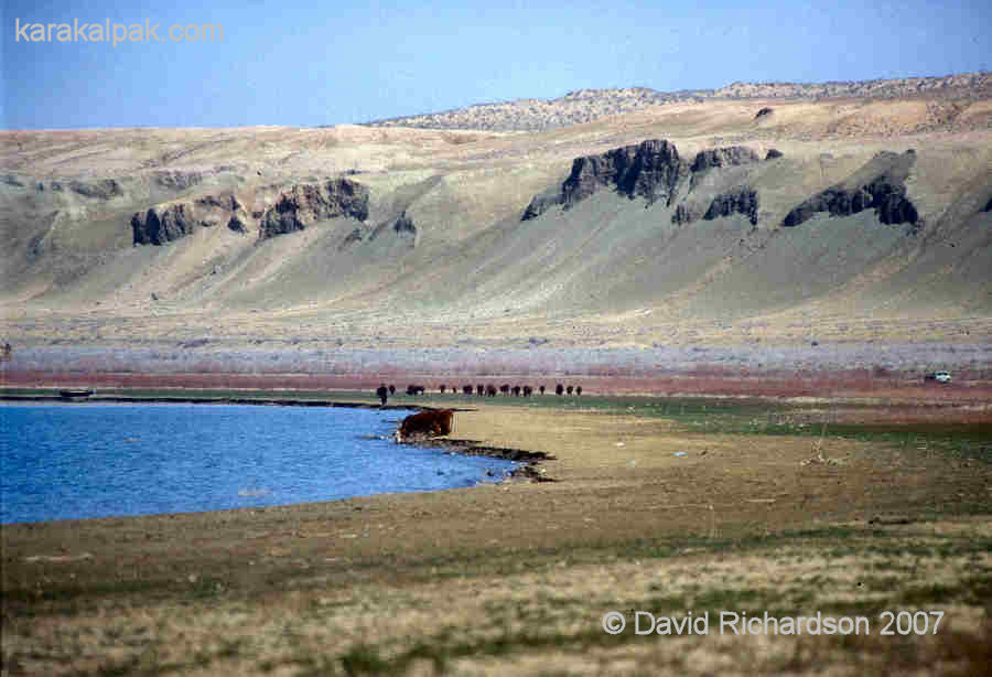
The Beltaw Heights
The Beltaw heights, sometimes referred to as the Beltaw hills or Beltaw ridge, stretch from the north of Taxta Ko'pir eastwards into the Qizil Qum.
They rise gradually on their northern side, but drop steeply to the west and south. With a maximum altitute of 142 metres above sea level they
once formed a barrier between the south-eastern corner of the Aral Sea and the Da'wqara Lake. The later has long ago disappeared and has been replaced
by marshy scrubland.
|
|
The Beltaw heights are remote and generally unexploited, apart from providing grazing for local cattle. They contain many endemic and rare reptiles
and are under consideration as a future nature reserve.
The Aral Sea and the Aral Qum
As we have already seen, the Aral cavity is an ancient geological feature that has been been flooded a multitude of times since its formation, in
some cases by huge inland bodies of water such as the Paratethys, Sarmatian, Maeotic, and Pontic Seas. The landscape of the present Aral Sea however
is much more recent. In the late Miocene, about 7 million years ago, tectonic movements led to the elevation of the Ustyurt and Vozrozhdeniye, forming
an island in the middle of the shallow Maeotic Sea. Although the surrounding sea eroded its perimeter, forming the early tchink, the surface
of the plateau was protected from further erosion by its armoured surface of Sarmatian limestones and sandstones. The onset of arid conditions some
4 to 3 million years ago may have led to the sculpturing out of the Aral depressions by a process of wind erosion. However the formation of the Aral
Sea had to wait until the arrival of the Syr Darya, an event that occurred at some time either before or just after the last Ice Age. It did not
reach a significant size until the arrival of the Amu Darya in the late 3rd or early 2nd millennium BC.
The Aral Sea is not strictly a sea but a terminal lake with no outflow. It has always been very shallow and because of its geographical location it
suffers from high levels of evaporation in the summer (currently equivalent to roughly one and a half metres of depth per annum). The balance between
its water inflow from rivers and local precipitation and its water loss through evaporation and seepage has always been fine, making it a
relatively unstable physical feature. Consequently during past episodes of low inflow, such as in the 2nd and 3rd centuries and the 15th and 16th
centuries, the Aral Sea has experienced substantial reductions in its size.
|
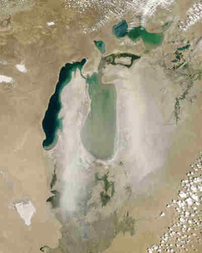
Today it is experiencing another severe contraction, although in this case the causes are manmade rather than natural. In 1960, when its maximum
depth was 68 metres, the Aral Sea could claim to be the fourth largest lake in the world after the Caspian, and Lakes Superior and Victoria.
However for the past forty-seven years it has been shrinking, its water supply a mere fraction of what it once was. Today it has fragmented into a
number of separate water bodies. The main part of the Sea has been divided into a shallow eastern basin and a smaller but deeper western basin.
The northern part of the Sea consists of a number of separate interconnected lakes that are collectively known as the Little Aral Sea.
The maximum depth of the main western basin is just over 40 metres and that of the main eastern basin a little more than 20 metres.
However the depth across the majority of the Sea is now less than 10 metres. Since 1960 the surface area of the entire Aral Sea has shrunk
by about 75% and its water volume by 90%. The one area that gives rise to hope is in the north in Kazakhstan where the World Bank has recently
funded the building of a permanent dam. This should allow the depth of the Little Aral Sea to increase in the future.
|
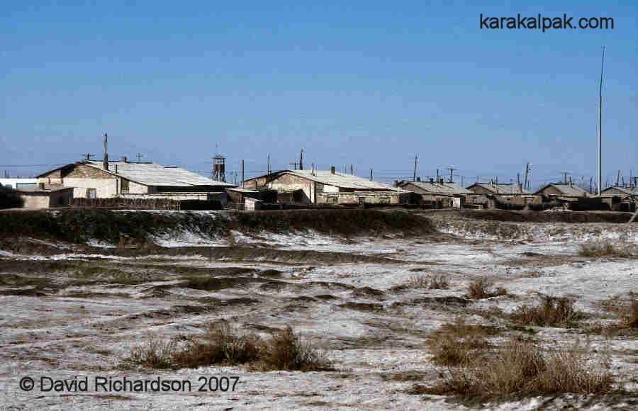
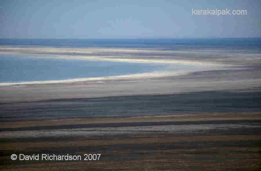
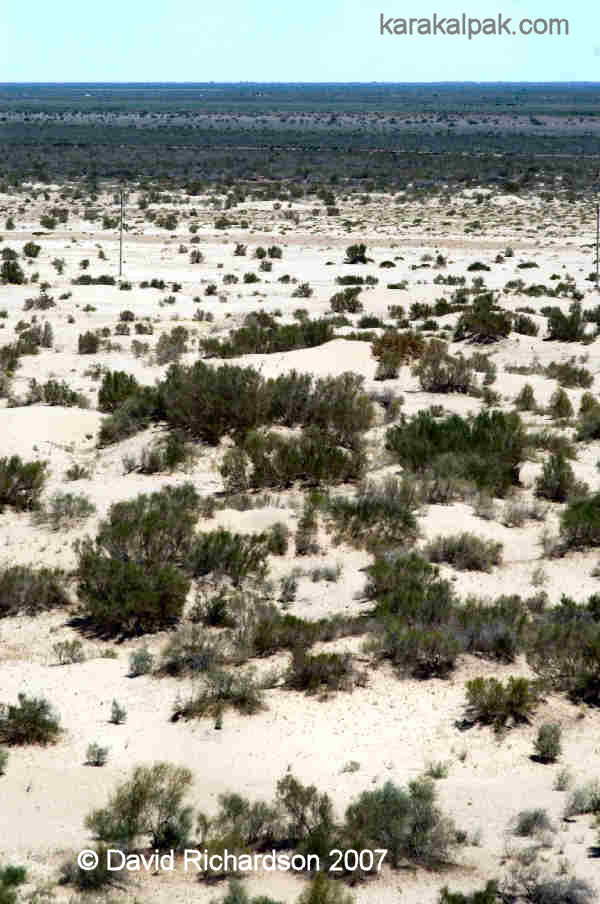
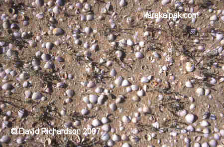
Today the sea laps up against the dried-out bottom of its former seabed, a sandy, sometimes muddy salt-encrusted plain covering more than 50,000
square kilometres, much greater in size than the remains of the sea itself. Some researchers, studying the speed at which vegetation invades this
virgin landscape, have termed the new desert the Aral Qum. There is a high probability that most of the eastern basin of the Aral Sea will disappear
over the next decade, greatly extending its coverage.
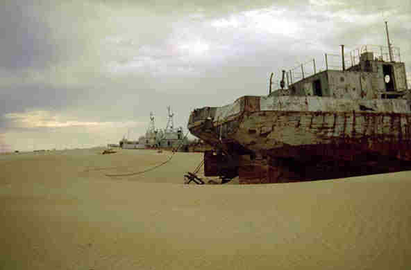
The dessication of the sea has had a devastating impact on the northern delta. The substantial fishing and shipbuilding industries have long gone,
as has the smaller holiday resort sector. The associated fish processing, canning, and smoking industries have been much reduced. The canning factory
at Moynaq is today processing fish caught in the local lakes and rivers. Most of the northern marshland has been destroyed and the cattle herds that
depended on them for grazing have gone. Local men find work in Qon'ırat or scrape a living either raising goats and sheep in the Aral Qum or
planting saxaul forests on the former seabed for a German aid project. According to Mr. Jarılkal Tursynbekovthe, the mayor of Moynaq, some 50% of
the working population of his town were without jobs in 2002.
|
|
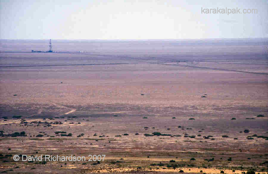
The main beneficiary of the dessication of the Aral Sea has been Uzneftegazdobycha, who have found it considerably easier and cheaper to explore
for hydrocarbons below the former seabed. Now that considerable gas reserves have been discovered, the Aral Qum will have considerable economic value
for Tashkent. However unlike fishing and shipbuilding, natural gas extraction is a capital-intensive rather than a labour-intensive industry. It will
provide few jobs for the many unskilled and unemployed residents of Moynaq and the northern delta.
Vozrozhdeniye Island
It seems likely that the north-south ridge of Vozrozhdeniye was elevated at the same time as the Ustyurt. Whereas the Ustyurt was protected from
erosion by its limestone shield, the narrow ridge of Vozrozhdeniye was far more vulnerable to sea, wind, and rain erosion and was quicky levelled.
In September 1848 Lieutenant Butakov and Academician Karl Ernst von Baer discovered a small island in the centre of the Aral Sea, which they named
the Island of Nicholas the First in honour of the Tsar. The value of this remote location was soon exploited by the Tsarist authorities, who opened a
miltary prison on the island. In the early 1930s the GPU secret police turned the prison into a concentration camp for Stalin's hated kulaks,
the bays, and peasant landowners. They sarcastically named the camp Vozrozhdeniye, meaning rebirth or renaissance in Russian. This subsequently
became adopted as the name for the whole island.
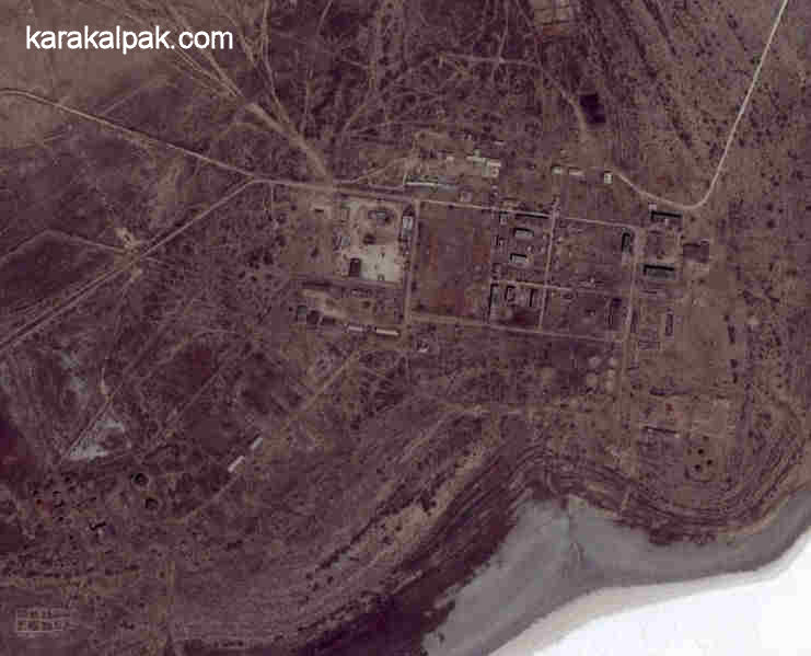
In 1954 the Soviet Ministry of Defence established the biological warfare facility known as Aralsk-7 on Vozrozhdeniye and neighbouring Komsomolsk Island,
following a Soviet decision to resume biological weapons testing two years earlier. Aralsk-7 was run by scientists but controlled by the military – it
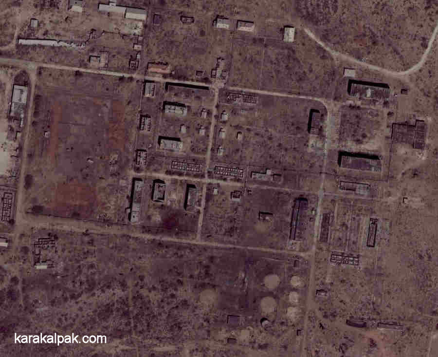
had its own dedicated military detachment under the control of a base in Aralsk. The laboratory buildings and military barracks were constructed at
Kantubak on the north-east coast of the island, along with accommodation, schools, a cafeteria, and a power station. An airstrip on Barkhan Island
provided plane and helicopter links to Aralsk, and a ferry connected the island to Aralsk and to Udobnaya Bay on the eastern tchink. The
southern part of the island became an open-air test site with an array of telegraph poles spaced at one-kilometre intervals for testing the range and
dispersal of infectious biological aerosols. The agents tested included anthrax, brucellosis, bubonic plague, smallpox, and typhus. Experiments were
not only conducted on laboratory mice and guinea pigs but also on sheep, donkeys, horses, and monkeys. Their corpses were incinerated in a mobile
autoclave. Tests were only conducted when the wind was blowing to the south – away from the research village and towards Karakalpakstan. The island
was protected from intruders by fast patrol boats. No'kis and the surrounding region were already strictly off-limits to foreigners. Despite its
remoteness, high-flying Canberra and later U2 spy missions soon tracked down the existence of the top-secret site. The Americans noticed that it
was remarkably similar to their own biological weapons test facility at Dugway.
|
In 1973 the USSR, USA, and UK signed the Biological and Toxic Weapons Convention, agreeing never to develop, produce, or stockpile biological weapons
and to destroy all existing stocks. However the Convention failed to include any mechanism for verification. Fearing that the USA would continue
its own programme in secret, the Soviets decided to maintain a covert programme operated by Biopreparat, established as a pharmaceutical cover operation.
The totally isolated facility on Vozrozhdeniye Island suddenly became an extremely valuable asset. The laboratory complex was expanded to eventually
accommodate over one thousand scientists, who lived on the island with their families. One enterprising journalist researching this site recently
tracked down some of the people who once worked on the island. They recalled its idyllic setting in the middle of the Aral Sea, and how they spent
their free time painting and sketching. By day they worked on the development of strains of anthrax, bubonic plague, and smallpox that were
super-resistant to antibiotics and then tested them on animals before they were "weaponized" for use in ballistic missiles. Details of the nature
and scale of the Soviet programme caused a massive shock in the West when they were made public following the defection of Kanatjan Alibekov, the
Qazaq First Deputy Director of Biopreparat, to the USA in 1992. Now a US citizen, Ken Alibek - as he is now known - has testified that testing on Vozrozhdeniye
only took place at night, to avoid US satellite detection. Soviet scientists positioned caged monkeys on pylons across the test site before firing
bomblets overhead, which released their deadly contents for dispersal downwind. Hundreds of monkeys were horrifically poisoned with these appalling
materials every year.
|
In 1979 an accident at a germ warfare factory in Sverdlovsk in the Urals led to a release of anthrax and the death of 70 people. The incident raised
US suspicions and led to a decade of increasing pressure from the West on the Soviet Union to verify that it had not broken its obligations under
the Biological Weapons Convention. When the USA began pressurizing for the direct inspection of possible anthrax production sites, President Gorbachëv
had issued instructions in 1988 to "Get rid of it! Hide it!". According to the Soviet bio-weapons defector Kanatjan Alibekov stocks of weapons-grade
anthrax held at Irkutsk were dissolved in calcium hypochlorate and then shipped to Aralsk in drums by rail and transferred to Vozrozhdeniye Island.
The anthrax was then emptied into eleven shallow pits at a depth of just 1 to 2 metres.
Following Uzbek independence the new Uzbek government sought information on abandoned Soviet research sites on its territory including Aralsk-7. At
first the Russians refused to hand over details of such projects, but they finally relented in 1995. The Uzbeks (and the Qazaqs too) sought US
assistance and a Department of Defence team visited Vozrozhdeniye Island in the same year. Fortunately US intelligence experts were able to locate
the burial sites by referring to historical satellite images taken while the pits were being dug. Despite having been treated with concentrated
chlorine from the hypochlorate, tests showed that some of the anthrax spores were still alive. This was an alarming finding since the falling level
of the Aral Sea would mean that the island would soon become reconnected to the southern mainland, making it possible for insects, rodents, lizards,
or birds to spread spores into the human population. The US Defence Department was more concerned that the weapons grade anthrax might fall into
terrorist hands.
|
In 1999 an Uzbek-US bilateral agreement was signed, allocating $6 million for the clean-up of the biological weapons facility on Vozrozhdeniye Island.
A plan was presented to the Uzbek military early in 2002 to treat the anthrax-contaminated soil with more calcium hypochlorate decontamination solution
later that year. A team from the Pentagon's Threat Reduction Agency flew into Moynaq and were helicoptered out to Kantubek with their equipment in
May 2002. After identifying the location of the pits they soon obtained positive tests for the presence of live anthrax spores. Over the next few
months the team dug up between 100 and 200 tons of contaminated soil and placed it into pits lined with thick plastic and filled with calcium
hypochlorate solution. After six days of chlorination the submerged waste was found to be devoid of any live spores and was buried for a second time.
Of course the rest of the site was left untouched. When the UK academic Nick Middleton illegally visited Aralsk-7 in 2005 he was shocked to find
ransacked laboratories and heaps of broken laboratory glassware. The cleanup is still far from complete.
The chemical weapons facility in No'kis was also dismantled with US help later the same year.
References
Anon., Joint Environmental Programme, South Karakalpakstan Main Collector Drain Project, Uzbekistan, Volume III: Terrain Analysis Mapping,
Report prepared for the EU Tacis Programme, Environmental Resources Management Limited, January 2003.
Anon., Soviet Topographical Military Map Series, Uzbekistan [in Russian], Scale 1;100,000, Roskartographia, Moscow, 1942, Revised in 1989.
Anon., Water and Environmental Management Project, Sub-component A1, National and Regional Water and Salt Management Plans, Regional Report No. 2,
Apendix A-11, GEF Agency of the IFAS, prepared by Royal Haskoning, Amsterdam, 18 September 2002.
Babushkin, L. N., editor, Soviet Uzbekistan, Progress Publishers, Moscow, 1973.
Bozheyeva, G., Kunakbayev, Y., and Yeleukenov, D., Former Soviet Biological Weapons Facilities in Kazakhstan: Past, Present and Future, CNS Occasional Papers, Monterey Institute of International Studies, California, 1999.
de Shutter, J., and Dukhovny, V. A., editors, South Prearalie - New Perspectives, Ecotech Resource and SIC ICWC, Tashkent, 2003.
Glazovsky, N. F., The Aral Sea Basin, In Regions at Risk: Comparisons of Threatened Environments, edited by Kasperson, J. X., Kasperson, R. E.,
and Turner, B. L., Volume II, United Nations University Press, Tokyo, 1995.
Létolle, R., and Mainguet, M., Aral, Springer-Verlag, Paris, 1993.
Létolle, R., Aral Sea 1998, A short report on the observations made by the French expedition round the Aral Sea,
http://www.cig.ensmp.fr/~hydro/aral/aral.htm, May 1998.
Létolle, R., Considerations on the bottom topography of western trough of Aral Sea, http://www.cig.ensmp.fr/~hydro/aral/Bottom.pdf, 8 March 2006.
Lioubimtseva, E., Arid Environments, Chapter 12 in Physical Geography of Northern Eurasia, edited by M. Shahgedanova, pages 267 to 283,
Oxford University Press, Oxford, 2002.
Lioubimtseva, E., and Cole, R., Uncertainties of Climate Change in Arid Environments in Central Asia, Reviews in Fisheries Science, Volume 14,
pages 29 to 49, Taylor & Francis, 2006.
Miaud, C., Chikin, Y., Giacoma, C., Joger, U., Nurtazin, S., and Dujsebayeva, T., The present state of Aral Sea basin herpetofauna and
implications for conservation of natural habitats and biodiversity, INTAS, Bukhara, April 2003.
Micklin, P. P., Desiccation of the Aral Sea: A Water Management Disaster in the Soviet Union, Science, 241, pages 1170 to 1176, 1988.
Middleton, N. J., The Aral Sea, Chapter 22 in Physical Geography of Northern Eurasia, edited by M. Shahgedanova, pages 497 to 510,
Oxford University Press, Oxford, 2002.
Middleton, N. J., Extremes Along the Silk Road: Adventures Off the World's Oldest Superhighway, John Murray, London, 2005.
Murzayev, E. M., Research on the Aral Sea and Aral Region, Post-Soviet Geography, 33, Number 5, pages 296 to 314, 1992.
Nurmukhamedov, M. K., Muminov, I. M., and Dosumov, Y. M., History of the Karakalpak ASSR, Volume 2, Fan Publishing, Tashkent, 1986.
Orlovsky, N., and Orlovsky, L., White Sandstorms in Central Asia, Chapter 8 in Global Alarm: Sand and Dust Storms from the World’s Drylands, United Nations, Bangkok, 2001.
Pala, C., Hunting down tons of anthrax on a remote island, San Francisco Chronicle, 24 March 2003.
Severskiy, I., Chervanyov, I., Ponomarenko, Y., Novikova, N. M., Miagkov, S. V., Rautalahti, E., and Daler, D., Global International Watrs Assessment
Aral Sea, GIWA Regional Water Assessment 24, University of Kalmar, Sweden, 2005.
Sidorova, I. P., Regional Lineament Net of Uzbekistan: RemoteSensing and GIS, mineral deposits and geodynamic structures, Eos Transactions
of the American Geological Union, Volume 86, Number 52, 2005.
Sinnott, P., The Physical Geography of Soviet Central Asia and the Aral Sea Problem, in Geographical Perspectives on Soviet Central Asia,
pages 75 to 100, Routledge, London, 1992.
Small, E. E., Sloan, L. C., and Nychka, D., Change in Surface Air Temperature Caused by Desiccation of the Aral Sea, Journal of Climate, pages 284
to 299, Volume 14, Issue 3, February 2001.
Tucker, J. B., Biological weapons in the former Soviet Union: an interview with Dr. Kenneth Alibeck, The Nonproliferation Review, Spring/Summer 1999.
United Nations, Report on the OCHA-UNDP-WHO Mission to Uzbekistan, Office for the Coordination of Humanitarian Affairs, UNDP, 1-7 July 2001.
Visit our sister site www.qaraqalpaq.com, which uses the correct transliteration, Qaraqalpaq, rather than the
Russian transliteration, Karakalpak.
 |
This page was first published on 11 March 2007. It was last updated 27 February 2012. © David and Sue Richardson 2005 - 2015. Unless stated otherwise, all of the material on this website is the copyright of David and Sue Richardson. |